Default
- Default
- Title A to Z
- Title Z to A
 Refine Search
Loading

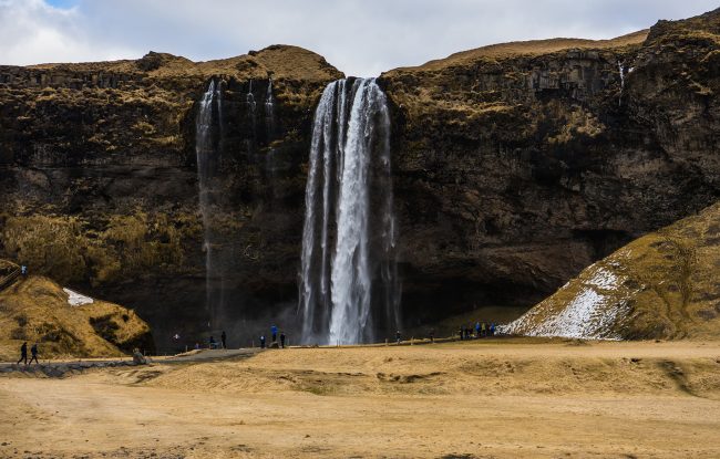

If you are in Iceland it‘s a place to stop at, even though it can be a bit crowded during the day it‘s still worth the visit. Seljalandsfoss is running from the mighty Eyjafjallajökull, if you haven‘t heard about it you missed a lot. Eyjafjallajökull erupted in 2010 causing a big part of the air traffic in the world to stop due to ash. The waterfall itself is stunning with its beautiful cliffs and grassy slopes. The waterfall is 62 meters high and you can walk behind it. When walking behind it you will get wet, so wear rain clothes if you don't want to be soaking. If traveling in the winter the walking path can be closed due to the icy condition.…
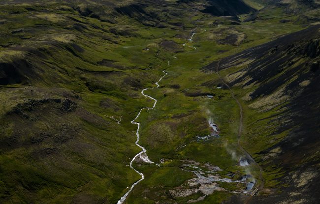
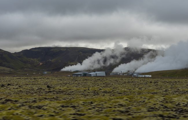
Reykjadalur Reykjadalur is a valley located above the town Hveragerði in the south of Iceland. Reykjadalur means the steam valley and you will see why. Reykjadalur has got pretty popular in the last few years and more and more people visit the valley these days. Reykjadalur is a part of the Hengill area which is a volcanic area covering about 100km2. The last eruption of the area happened about 2000 years ago. The area is a very important source of energy for the south with all its geothermal activity. Reykjadalur is also a popular place for hot spring bathing, and we recommend you to try that out. The walk starts at the end of the town Hveragerði. First, you drive to the …
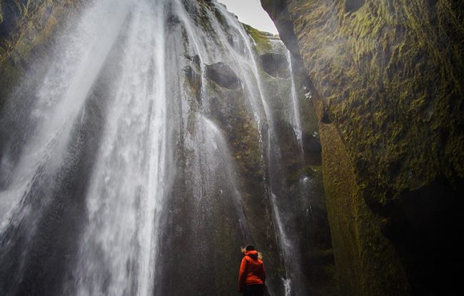
One of my favorite waterfalls, it‘s little hidden pearl right next to Seljalandsfoss. So if you have already been at Seljalandsfoss, just keep driving few hundred meters until you see a campsite and a little canyon on your right hand sight or you can walk there from Seljalandsfoss, it's a ten minutes hike. You can park your car below the campsite and walk through the campsite. There you will see a crack or a little opening where you have to walk through to get to the waterfall, which is in the cave. There you will get even more wet then behind Seljalandsfoss, so get ready for that. But believe me it‘s worth it. If you have waterproof shoes, now is the time to wear them.…
Driving through Hellisheiði the hillside you drive when driving from Reykjavík to Hveragerði. Is a well known outdoor activity area for the capital area. Around this area, you will find nice hiking and biking trails making this a popular area for locals to go out and enjoy outdoor activities. There you will find the Bláfjöll area, which is the biggest ski area in Iceland, even though the area is quite small and with a low mountain, it‘s better than nothing. Around the Bláfjöll area, you will find lava fields, with caves and lava tunnels. The most famous one is Þríhnjúkagígur which is an enormous magma chamber, it‘s the only magma chamber in the world that can be entered. Only possible going …
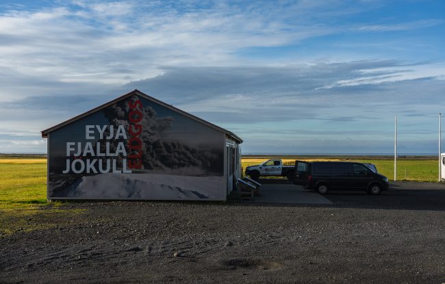
Is a big farm in the south, in the year 2011 the farmers decided to open an exhibition about the eruption in 2010. On the other side of the road you can have great view of Eyjafjallajökull if the weather allows it.…
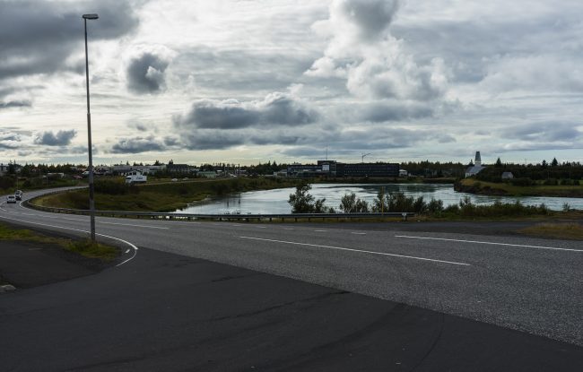
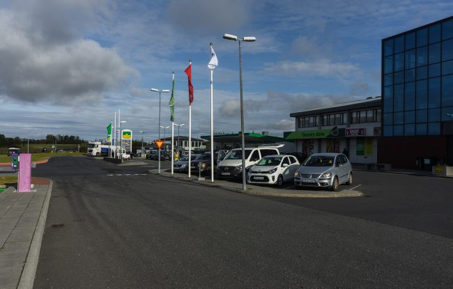
Located 50km east of Reykjavik on the road n°1, Selfoss is the biggest urban area of the south coast, with around 6500 peoples living there. It's a good spot to gear up before traveling further east with groceries or having lunch and dinner in one of the many restaurants and fast food in town. Did you know that in 1941 a German aircraft attacked Selfoss, killing three members of the British occupying forces? In 1944 the old bridge over Ölfusá river at Selfoss, dated from 1891, collapsed when two milk truck crossed it at the same time. A new bridge was built in 1945.…
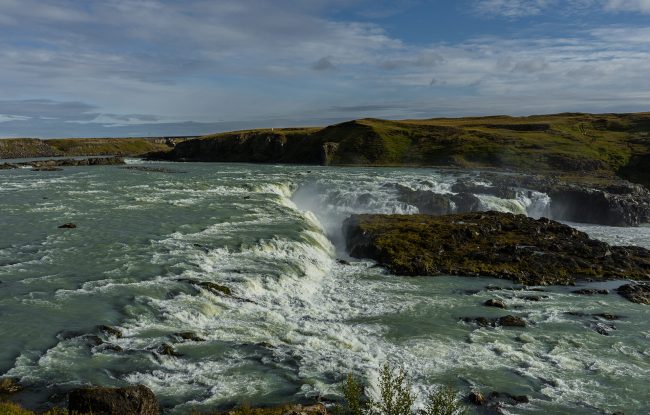
A waterfall in Þjórsá river. Þjorsá river is the longest glacier river in Iceland, about 230 kilometer long, it‘s also the most powerful one carrying about 360 m3/sec of water. The water is coming all the way from Vatnajökull ice cap, coming out from under Hofsjökull. In 1927 a company was granted a permit to build a 160.000 horsepower hydro plant. This powerplant was suppose to supply Reykjavík for electricity. This powerplant was never built. …
94km east of Reykjavik on road n°1 there is a small town called Hella, it counts around 800 peoples living there. It's a very small place, there you find a gas station, supermarket and swimming pool and even an airdrome which is the only one operating skydiving during the summer season in Iceland.…
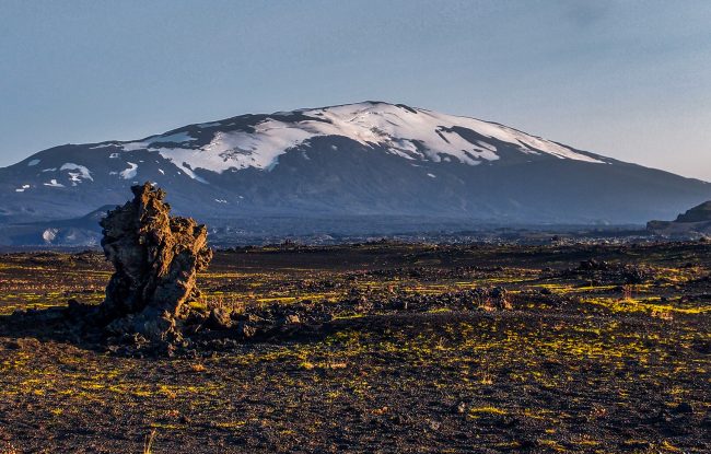
When driving around Hella you might see the mighty Hekla. Hekla is one of the most famous volcanos in Iceland. Hekla is 1491 meters high. Hekla was feared before, it was told to be the gateway to Hell and even considered to be Hell. Nobody dared to climb the mountain until 1750, and they wanted to prove that this was all just a myth. Hekla has erupted quite often in recent times causing destruction in the nearby areas. Hekla erupted last in the year 2000, they predicted that eruption 15 minutes before the eruption. So you better know how to run if you decide to climb the mountain. In the recent years, we have had warnings about the mountain and that it‘s showing signs of eruption, but we are…
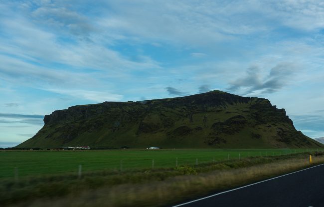
The hill is about 277 meters high. In the Sturlung Age, the rocky eminence of Pétursey served as a fortress. A force of 200 men is said to have defended themselves from attack here.…
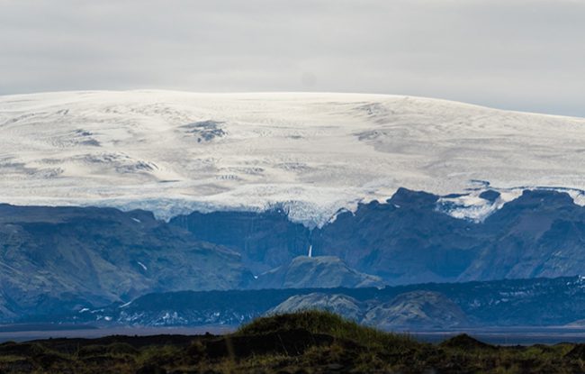
It is the fourth biggest glacier in Iceland. Mýrdalsjökull is 590 km2. Underneath the glacier, you can find Katla, Icelanders most frightening volcano. Upon the glacier, you can do some snowmobiling tours.…
Is one of the biggest volcanoes we have in Iceland. The volcano is about 30 kilometers in diameter and the highest point is about 1400 meters. The history has shown that Katla erupts every 40-80 year apart. 16 eruption have been documented in the volcano since the settlers came. The last eruption was in 1918 meaning it's way overdue. The last few years we have had few warnings every year that something is going on and we have experienced some glacial outburst. Katla hasn't erupted yet though, so we are still waiting.…